- cross-posted to:
- geophysics
- cross-posted to:
- geophysics
cross-posted from: https://lemmy.ca/post/12981758
With apologies for the colour scheme (I’m so sorry if you’re colour blind!). This is the lower layer of a two layer 1D inversion model, interpolated. Was playing with maximizing the contrast to try to find the foundation of the Richardson Mansion that existed on this property prior to it being bulldozed in the 70s and donated to the City of Winnipeg to become Munson Park. I’m pretty sure I captured it in the red square in the middle.
As someone who was just scrolling new, what is this? I’m guessing you didn’t run ground penetrating radar in a public park, right 😂?
Well, pretty close :)
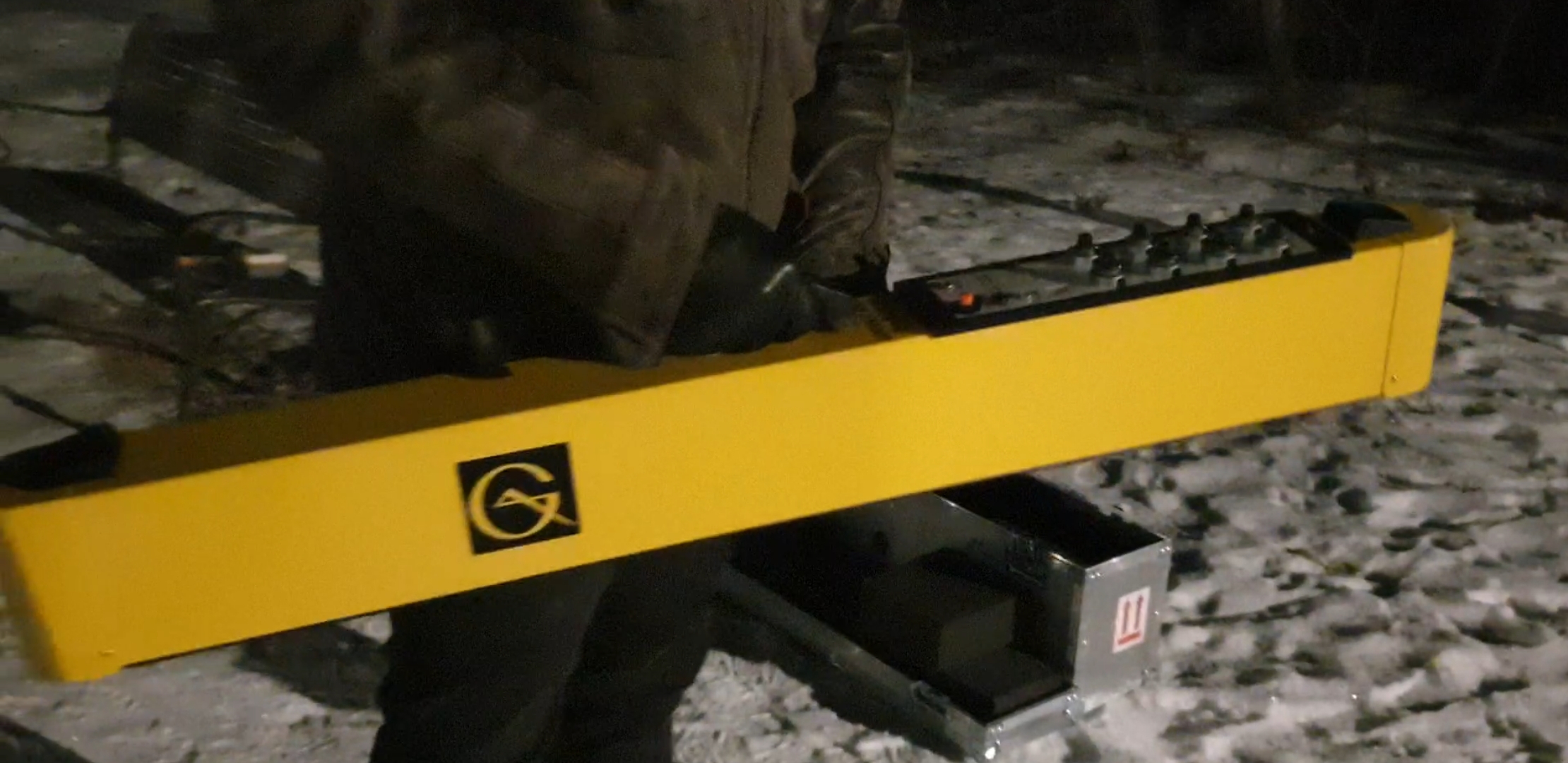
This is an electromagnetic scanner. It’s basically a magnetic coil that you pass electricity through, this generates a magnetic field in the earth directly beneath the scanner (about 1m around the device). If the earth is electrically conductive or resistive, it responds differently. Add a GPS and walk around with it… $40k soil mapper that you carry about to make a map and it doesn’t even touch the ground.
I knew the foundation would be there because I went to The Nutcracker at the Royal Winnipeg Ballet this Christmas. Before the show, they had a big curtain over the stage with a picture of a giant mansion on it. During the introduction, the director gave a tiny history lesson, saying that this mansion formed the basis of the backdrop they used for the ballet, and that it was a real place, and that place is now Munson Park. A little googling later, and it turns out that this was the Richardson family mansion until the 1970s when it was bulldozed and donated to the city to create the park. The Richardson family also sponsors the ballet. I was just sort of closing the loop for my own interest :)
I’ve previously reached out to the parks branch within the city about testing toys. They’ve given me tacit approval so long as I’m not disturbing anyone.
I thought it would be locally interesting to people in Winnipeg ;)
That’s pretty incredible. The backstory really makes this. Keep posting
This sounds like something I would love to try! How did you build the scanner, and then… Well build a map from it? I’m now realizing how little I know about this lol.
I didn’t build this scanner – this one was made in Toronto by a company called Geonics. But I’ve made similar equipment. This one operates at 14.5kHz, which is conveniently inside the human audio frequency range, so you can use off the shelf audio system components to cobble a similar system together. However, getting it right (calibrations and such) is the tricky part. Half the reason I was collecting this test data was to verify that I could use the instrument (we just bought it), and that the calibrations were sane.
It streams data out over a Bluetooth serial port. So it’s pretty easy to log it actually. We use a windows program on a field ruggedized table – it logs the raw data with timestamp and GPS position. But I could write a python script to do it, so the software isn’t that advanced :)
Later I pull it into QGIS (open source and pretty amazing), and make a heat map. The background imagery is pulled from Google Earth.
Geophysical equipment tends to be quite simple but also quite expensive. It costs a lot to make them – they’re mostly hand built. And they don’t sell in high volume, so to recoup your R&D costs, you set the price much higher than the components would dictate. Total cost of components in this unit would be something like $2k (excluding the tablet), but it sells for $30k. The manufacturer will be lucky to sell a half dozen globally each year, so most of the cost is in the salary of the technicians and engineers manually building them.
Going back to the audio components analogy – imagine them as high end guitars and amplifiers, hand assembled. Hell, much of the unit I used here is actually made out of wood (for it’s thermal properties, and electrical resistance).
Blurry photo of the unit from my testing. Weighs about the same as a guitar. And a bunch of dials on top too… ;)

As another new sorter (well, top 6 hour) i thought i was a dick outline and a troll post.
🍆
Will it find graves of children on residential school properties?
This device would be an unlikely choice, but it’s possible it could be an auxiliary piece of data in some locations where GPR is infeasible. We also have GPRs in our equipment pool, and many of them have been used in that context all over Canada.
Cool thanks
I can’t find any picture of the richardaon house. I wonder what it looks like while it’s being lived in.
It was a named manor. Something like Crescentwood. Let me see what I can find.
https://www.mhs.mb.ca/docs/features/walkingtours/crescentwood/index.shtml
Munson Park – This was the site of the farm house on what used to be Munson’s farm. Through the bush which still remains on the low part of the property, an old trail leads from the forks, along the south bank of the river and out to the west. The original home, built in 1889, was renovated and modernized during the time it was owned by the James Richardson family. It had its own private swimming pool and a large kitchen garden. It was demolished in 1980.
Page 39 of this document has a picture from 1919: https://engage.winnipeg.ca/14255/widgets/55213/documents/44165
This is so interesting, thank you for posting this! Definitely going to have a new perspective next time I’m strolling through Munson.


